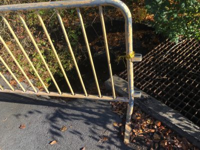
The photo shows a problem on the east side of the parking lot behind Sykes Student Union in West Goshen, just south of Rosedale AVe. from West Chester Borough. A large paved surface is drained by several grills and surface outflows, but water flow has caused subsidence behind this yellow barrier (actually a bicycle rack).
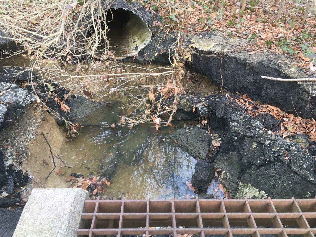
As shown in the first photo, storm water from that part of the lot now bypasses the grill and flows into the pit. If we look down inside in good light, we find that the pavement has subsided into the bottom of the pit (which is about 3 feet deep) and that not only water coursing off the lot but also the contents coming in from a pipe to the left flow into a larger pipe under the grill (photo 2).
Where does the water go from there? The lot itself includes no retention basin, and from surface drainage on the south side of the lot and from drains around the lot, water runs off into a wooded area to the south.
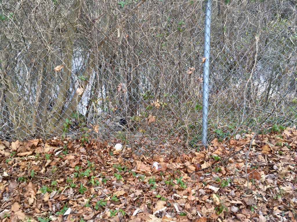
Looking closely there, we see (photo 3) a substantial pond stretching along the whole south side of the parking lot. Is this WCU property? Is it a planned retention area? Does it filter out car and road salt contamination and allow water to soak into the water table? And the answer to all those questions fortunately is Yes, per conversation with WCU personnel on Jan. 26.
This isn’t just a drainage question, but a historical problem, dating back to an era of much lower environmental consciousness. The main WCU campus was built on the upper reaches of Plum Run, which was put underground; its water now flows into the Brandywine River at route 52. WCU of course knows the needed corrective measures and has done well to install retention basins on New St. south of the Recreation Center, on Sharpless St. outside the Business and Public Management Center, and south of the lot at Roslyn Ave. south of Rosedale Ave.
Even assuming the Sykes parking lot is adequately served by the above-identified pond area, would it also be a good location to show off good water treatment through future retention basins, trees and rain gardens to absorb water and improve the scenery?
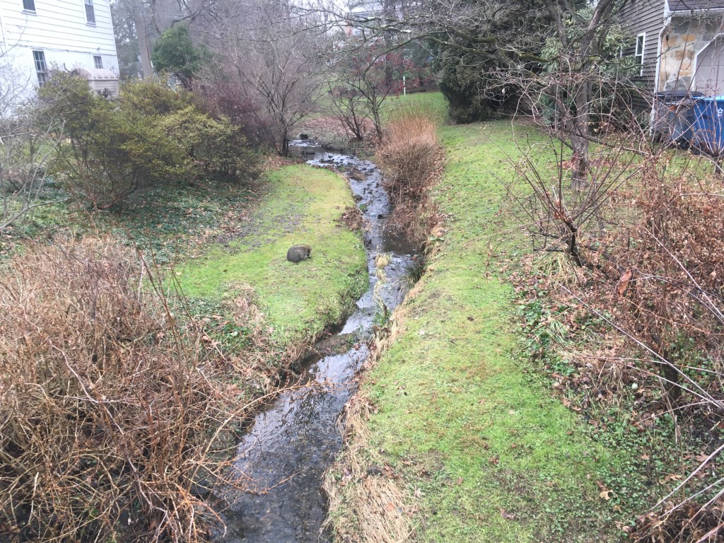
Be that as it may, at some point to the south, a stream (photo 4, seen from the bridge at Oak Lane, with the added attraction of a chilly groundhog or possum hunkering down to the left of the water) emerges from among private properties that prevent public access for the desired observations.
At any rate, the storm water south of Rosedale drains down toward WCU’s much-appreciated 126-acre Gordon Natural Area, which shows signs of stream erosion on the far bank (just behind the unfortunate extraneous object in photo 5, taken 12/13/20):

That’s what water does, seeking the easiest path downward, and when more of it runs off than an existing natural watercourse can handle, it damages built infrastructure, erodes stream banks and potentially causes flooding. Although based on current info the Sykes lot seems not to be contributing to any problems downstream, it is always good to evaluate water flow with the big issues in mind: retention, flooding, erosion.
